
August 9th, 2026 - 04:56 GMT

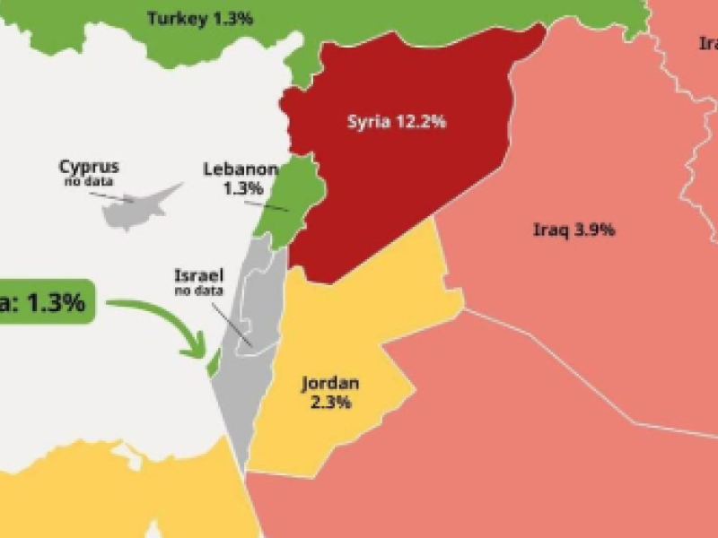
ALBAWABA - A map handed out by Israel’s Foreign Ministry has sparked a row because it seemed to show parts of occupied southern Lebanon as being inside Israel, sparking claims that the country is seeking to normalize territorial changes thru official government publications. The ministry’s X account posted the map in a post that showed child malnutrition statistics across the Middle East. The article was about humanitarian data but people ...